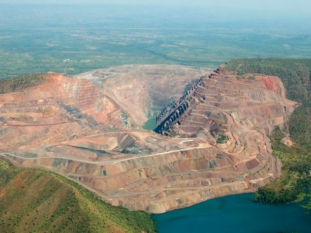
Welcomes you on board
for the
Purnululu Explorer Tour
This information booklet has been designed to assist you with absorbing the large amount of information shared during the tour, as well as being a handy reference guide and souvenir to take home.
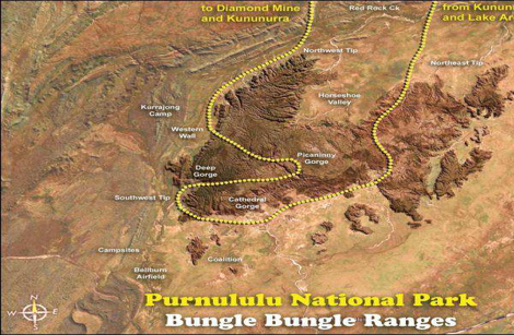
The in-flight commentary will provide information regarding landmarks and significant points of interest. Your pilot will identify these as they approach and provide additional commentary, including historical and cultural aspects of the area, while referring to the flight path on the map provided on the back of the booklet.
Also provided for your information in this booklet is the set flight pattern you will be travelling on over Purnululu National Park.
Safety: The aircraft you are travelling in is equipped with a first aid kit, emergency rations, water and a fire extinguisher.
Kununurra
Kununurra was established in 1961, making it the Kimberley's youngest town. The name 'Kununurra' comes from the local Miriwoong language and means 'big river'. The town exists because of the construction of the Diversion Dam Wall, which creates Lake Kununurra, and the Ord River Dam, which holds back the waters of Lake Argyle. The Diversion Dam was completed in 1963, comprising 20 radial gates, each weighing almost 100 tonnes, which have been designed to deal with a peak flow rate of 28,000 cubic metres per minute. Since then, the town has grown into the East Kimberley's major service centre.
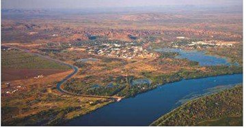
People had long been interested in harnessing the huge amounts of water that flowed through the Ord River every day; during the wet season, this flow can reach 2,500 gigalitres (GL) per day. Kimberley Durack's vision and enthusiasm brought the idea to life. Kim Durack established an experimental property in 1938 at Carlton Reach (Ivanhoe) to grow crops and pastures that could be used to fatten cattle. Kim's experimental farm, drawing water from the river for irrigation, was very successful, and he grew a wide range of grasses and legumes. During this time, he identified the ideal spot for the Ord River Dam Wall, which was established later.
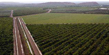
Ivanhoe Plains, at 13,000 hectares (ha), is the larger of the two main areas that make up the Ord River Irrigation Area (ORIA) Stage 1.
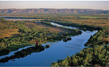
Before the dams were built, the Ord River dried up to a series of waterholes. Building the Diversion Dam Wall created Lake Kununurra, which provided irrigation water; however, the system still depended on Ord River flow. When the Ord River Dam Wall was completed in 1971 and Lake Argyle was created, reliable year-round water was provided for the whole OIRA. Lake Argyle is Australia's largest man-made lake, and since its creation, Lake Kununurra has been maintained at a constant level. An important advantage is that Ivanhoe Plains can now be gravity-fed from Lake Kununurra, so pumps are no longer required. In comparison, Packsaddle Plains on the south side of the lake still requires pumps for irrigation. Sandalwood is the dominant crop of this region, covering at least 50% of the total ORIA and still expanding. As a parasite, sandalwood requires two host plants throughout its life, and the heartwood yields oil when harvested at 14 to 15 years old. Chia seed is another exciting new crop. It is the richest plant-based source of omega-3 fatty acids, normally sourced from fish, and is also high in dietary fibre, protein, and antioxidants. Growing conditions in the Kimberley appear to maximise the plant's omega-3 content. Others smaller plantations include commercial rice and cotton, mangos, melons, papayas, sorghum, pumpkins, cucurbits and chickpeas.
Spillway Creek
This creek is man-made and acts as an overflow outlet during the wet season, allowing excess water from Lake Argyle to flow directly into the diversion dam.
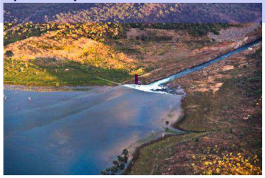
At the peak of the wet season, this creek has a volumetric flow of 3,540 cubic metres per second, enough to fill Sydney Lake Argyle Dam Wall
The Lake Argyle Dam Wall
was constructed between 1969 and 1971 and is 335 metres long and 98 metres high.
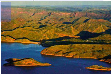
It was expected to take three years to fill, but it took only one and a half years. This earth-fill-only dam wall is Australia's most efficient dam in terms of the ratio of dam wall size to the amount of water it holds back. The lake was named after the property it partly submerged, Argyle Downs.
The Ord Hydro Electric Power station is at the base of dam wall and provides 30 MW of power – more than enough to drive Kununurra, Wyndham, and the Argyle Diamond Mine
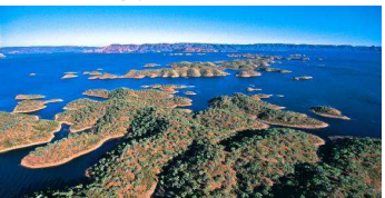
Lake Argyle
Lake Argyle was established to provide reliable storage of 11,000 GL, about 21 times the volume of Sydney Harbour. Amazingly, under peak flood conditions, the storage capacity increases to 40,000 GL, covering about 2,100 km*, which is equivalent to 80 Sydney Harbours! It is Australia's largest body of freshwater and is so large that it is classified as an inland sea. The main tributaries are the Ord and Bow Rivers, and most of the 55cm of rainfall between December and March flows into the Lake. An estimated 25,000 freshwater crocodiles live in the lake, but only seven larger, more aggressive saltwater crocodiles have been recorded; there could be more! The lake has 15 fish species, and 3-4 boats operate for 10 months of the year, producing an annual catch of around 4,000 tonnes. The main species include the Giant Las Fish (unique to the Ord River), Catfish (also known as Silver Cobbler), which supports the commercial fishery, and Barramundi.
Zebra Rock Peninsula
This peninsula contains the world's only known deposits of Zebra Rock.
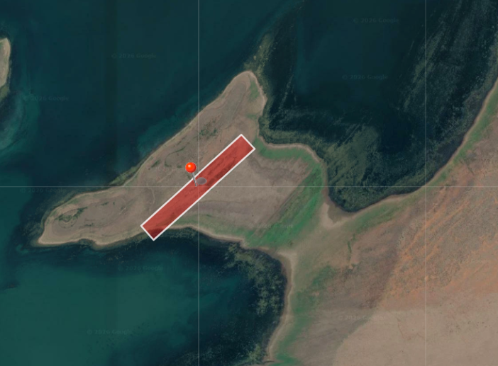
Unfortunately, several other sites were buried under Lake Argyle. This fine-grained sandstone is very attractive, with rhythmic patterns of reddish spots or stripes against a white base, formed around 600 million years ago. They mine these rocks for only one month per year, in October/November, because of lake water levels and concerns about possible environmental impact.
Smoke Creek
The first diamonds in this area were discovered in August 1979. Although only two small diamonds were found, they were enough to excite CRA (now Rio Tinto) geologists and encourage further exploration. However, a rival German uranium mining company held a short-term lease on the area at the time, so CRA kept the discovery quiet, pulled up its geology camp, and moved out of the area. When the German company did not renew their lease, CRA snapped it up. Their geologists and crew worked along the creek, finding more and more diamonds, until they discovered the host ore body at the headwaters, now known as the Argyle Diamond Mine.
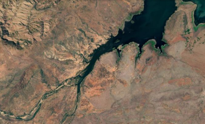
Bow River Diamond Mine
Today, three consecutive square levels merging from the ground are the only remnants of the Bow River Diamond Mine. It opened in 1988 and ceased operations in 1996 because land-rights claims remained unresolved. It operated as an alluvial mine, recovering one million carats of diamonds (200 kg) each year. Operators processed the top 2-3 metres of soil along Limestone Creek to recover diamonds that had travelled along Argyle's main host ore body due to millions of years of erosion.
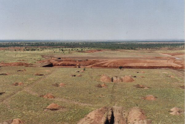
Lissadell Station
Lissadell Station is the region's largest working cattle station (185,000 ha) and was one of several properties the pioneering Durack family established on the rivers of the East Kimberley. The Duracks left Queensland in 1883 with over 6000 cattle and several hundred horses to explore the Kimberley. They heard reports from explorer and politician, Alexander Forrest, of extensive well-watered grasslands in the Kimberley. Losing half their stock on the trip over, they finally arrived in 1885. They found that the surviving cattle were well suited to the environment, and their numbers multiplied to 24,000 in just five years. This breed is called Brahman, and it adapts to this climate by using the humps on its neck to store fat and water to sustain it through the dry season. Another coping mechanism this breed has for tropical climates and insects is having more sweat glands to cool themselves quickly and oily skin to repel insects. The traditional shorthorn, on which the cattle industry was founded, proved less adaptable and suitable. The first herds arrived in the 1880s, establishing the pastoral industry through overland movement of cattle from Queensland and New South Wales, with approximately 100 pastoral stations remaining in the region today. The value of local cattle disposals was $48 million in 2003/04 (9.7% of the State total), increasing to a massive $139 million in recent years. The Kimberley herd of beef cattle is around 600,000 today (about 30% of the state’s total), with most Kimberley cattle exported live to Indonesia, Malaysia, and the Middle East.
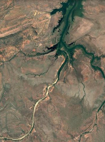
Crossing Bow River
In the 1880s, when these cattle stations were being established, it was not feasible to try to fence them, so natural boundaries were used wherever possible. One such boundary was the Bow River between Lissadell Station and Texas Downs Station. However, in the dry season, with so little water in the river, it is hardly any barrier to the cattle. This is one reason mustering starts as early as possible each year, around March, so owners can round up unbranded cattle before their neighbours do!
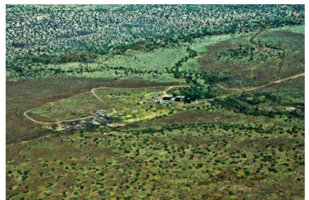
Texas Downs Station
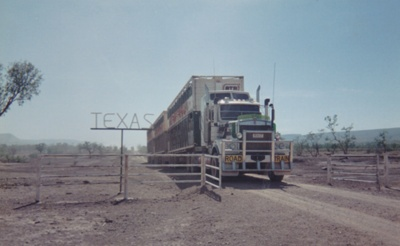
Texas Downs Station is very remote, situated 40 km from the main road to Kununurra. The station is cut off during the wet season, and with no airstrip, transport is limited to helicopters. Cattle Creek is a tree-lined creek that runs North to South and acts as a cattle ‘highway’ during the dry season, allowing cattle to reach Lissadell to find water rather than take the stressful trip by truck on the rough dirt road.
Osmond Ranges
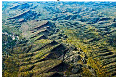
The Osmond Ranges are unique, wave-like forms differing distinctly from everything around them. They were formed by tectonic plate movement and were originally 30,000 feet high, complete with glaciers – taller than Mt. Everest! However, 340 million years of wind and water erosion have carved them away to their current height of around 2,000 feet. Amazingly, the resulting sediment deposited to the south formed the famous Bungle Bungles Ranges.
Bungle Bungles Ranges
The Bungle Bungle Ranges are located within Purnululu National Park, which was inscribed on the World Heritage List in 2003 for its outstanding universal natural heritage value. Scientists indicate that Aboriginal people have lived in the area for at least 20,000 years, and that it is rich in ancient artwork, burial sites, and other sacred sites. The first Europeans to discover the Bungles were a small party led by Alexander Forrest, an explorer and politician, in 1879. They visited the region but were not impressed by the natural beauty of the area, as they were focused on locating gold and productive grasslands. He was, however, impressed by the "20 million acres of well-watered grasslands" his party discovered in the Kimberley. For over a century, only local pastoralists, geologists, scientists, and local Aboriginal people knew these ranges existed. In 1982, journalists began filming a documentary on the cattle industry and captured the amazing beauty of the Bungles on film. This was when the Bungles caught the world’s attention. After the film’s release, an extensive publicity campaign was launched, and a track from the main road was extended, providing public access to these remote and ancient wonders. In 1987, the region around the Bungles was designated a National Park.
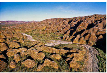
The sand and gravel foundation that forms the sandstone of the Bungles was deposited by rivers 340 million years ago. Millions of years of weathering have eroded the sandstone, producing the towers and banded beehive structures we see today. These ‘beehives’ are the outstanding feature of the Bungles and are internally composed of very fragile white sandstone- so fragile that people visiting the park are requested not to climb on them. The dark bands, winding horizontally, are formed by cyanobacteria living on the surface, contrasting with the lighter orange sandstone.
The Bungle Bungle Ranges' spectacular features are unrivalled in their scale, grandeur, and diversity of forms. The park's domes, gorges and seasonal waterfalls are utterly breathtaking.
Piccaninny Gorge is the Ranges' longest and deepest gorge, measuring about 6 km in diameter, and was formed by a meteor impact nearly 100 million years ago. Lightning Rock is another amazing feature in the Bungles. It is located on the western side and was formed when lightning struck the wall over a decade ago, exposing the pure white sandstone. The protective layer that was burnt off the rock will gradually regenerate over the next five years until no evidence of this event remains. The west and north sides of the area have a very different structure and origin from the ‘beehive’ domes in the eastern part of the Bungles. These parts are largely composed of conglomerate rock, a sedimentary rock made up of many types cemented together. Some boulders in this section show signs of glaciation, having been brought down by glaciers from the huge mountain range that once stood where the Osmonds are now.
Argyle Diamond Mine
The Argyle Diamond Mine commenced operations in 1985 and is owned by Rio Tinto. It is the world's largest producing diamond mine, producing 6 tonnes per year (30 million carats, or 16 kg per day). Colours include white, champagne, cognac, and pink, with pink being very rare (less than 1% of those found are pink). Argyle diamonds are unique for three reasons: they are harder than any other known diamond, they are mined from lamproite (as opposed to Kimberlite), and they shine brilliantly under UV light, making them very sparkly in sunlight. The operation is huge, processing 11 million tonnes of ore to produce 6 tonnes (35 million carats) of diamonds every year. The diamond quality breakdown is 80% industrial, 15% near gem, and only 5% gem quality. The mine operates 24 hours a day, seven days a week, with around 600 workers having an average income of $80,000 pa. Production output is gradually declining; the mine was originally planned for closure in 2010, but with underground mining deemed viable, the mine's life has been extended to 2020. The Argyle Diamond Mine airstrip is the largest privately owned in the Southern Hemisphere, with around $20 million in diamonds located beneath it. The roads and airstrip were constructed using tailings, micro diamonds too small to be separated out, making the roads and airstrip ‘diamond- studded’! Meanwhile, the mine has been closed.